NAST honors OMLC Professorial Chair Awardee, Dr Paringit, with Outstanding Young Scientists Award

Scientists Analyze Changes in Climate Extremes in Global Urban Areas
December 11, 2016
OMLC Scientific Director presents at the International Scientific Conference in Paris
December 11, 2016NAST honors OMLC Professorial Chair Awardee, Dr Paringit, with Outstanding Young Scientists Award
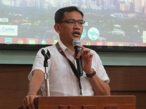
Dr. Enrico C. Paringit, OML Center Professorial Chair Awardee, is one of the awardees of the Outstanding Young Scientist for 2015 given by the National Academy of Science and Technology (NAST), Philippines, in recognition of his valuable contributions to the field of geodetic engineering research.
His studies focus on climate change/disaster risk management, in particular the acquisition, validation, processing, and application of datasets derived from the use of the light detection and ranging (LiDAR) technology. Together with his team, Dr. Paringit spearheads a pioneering work on these high resolution, detailed, and up-to-date national elevation maps, conducted across the Asia-Pacific region. His commitment has been exemplary despite challenges throughout the project, especially during the start of the program.
Dr. Paringit believes that the use of advanced scientific methodologies in supporting the country’s disaster mitigation efforts is the cornerstone of a “build-back-better” strategy, acknowledging the average 20 typhoons that affect our country annually and its impact to economic development. “Without proactive planning,” he said, “every natural disaster will greatly affect our country in terms of loses to lives and properties.” LiDAR data could help provide science-based information to cushion us from the devastating effect of the disasters.
His pioneering work has led the Aquino government to acknowledge the benefits of the technology, which prompted ad hoc assignments to assess the Yolanda Damage and Rehabilitation Work, the Effect of the Bohol Earthquake, the LiDAR assessment of Compostela Valley after Typhoon Pablo, as well as the Assessment of the Cocolisap Infestation.
The data and knowledge products, derived from the work of Dr. Paringit and his team, are important planning tools in facing disasters like floods, landslides, and other natural hazards. These are also instrumental in urban planning, infrastructure design, mining, agriculture, insurance, and a host of unexplored areas.
Dr. Paringit’s important work on the LiDAR program earned him on behalf of his team the World Geospatial Excellence Award in Geneva, Switzerland and the Asia Geospatial Award both in 2014.
Dr. Paringit received his degree in B.S. Geodetic Engineering from the University of the Philippines Diliman, where he placed 2nd in the Professional Geodetic Engineers examination in 1997. He acquired his M.S. in Remote Sensing in the same university (1999), and Doctor of Engineering at the Tokyo Institute of Technology (2003).
Article contribution by: Darvin S. Rosa, NAST