OML Center releases hazard and vulnerability maps

Academic/Research Sector tackled Post-2015 DRR Framework
December 9, 2016
HIRING: RESEARCH ASSISTANT
December 9, 2016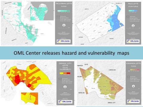
by: Justine Ravi C. Orduna
The OML Center releases hazard and vulnerability maps generated under its Special Project (SP) Yolanda.
These include flood, rain-induced landslide and storm surge maps as well as the administrative and buildings map, and the topography and hydrology map for Tacloban City, Ormoc City, Palo and Kananga, Leyte. The social vulnerability maps at the barangay level are also available for Tacloban City and Ormoc City.
These maps are among the final outputs of SP Yolanda, an Evidence-based Rehabilitation Study in the Yolanda-affected Areas initiated by the Center on November 2013 and to be concluded on March 2015.
To download the maps, please refer to the following links:
Tags: